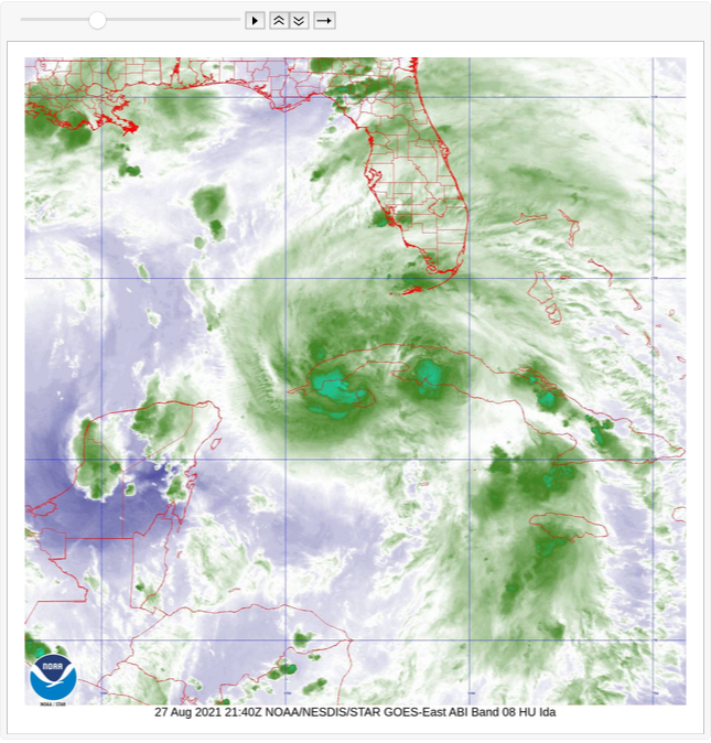
Hurricane Ida is expected to be a category 3 or 4 hurricane upon landfall on the Louisiana coast. The National Weather service has trained one of its weather satellites on Ida, to monitor its development and impact on the coastal population. The images generated by NOAA are in the public domain and available from their web servers. The images are taken at various wavelengths (bands), like infrared. Details on these “bands” can be found here: https://www.weather.gov/media/crp/GOES_16_Guides_FINALBIS.pdf
The following Wolfram Language code imports the latest images for each band and creates a looping animation from them.
In[]:=
base="https://cdn.star.nesdis.noaa.gov/FLOATER/data/AL092021/";
In[]:=
dirs=DeleteCases[Rest[Cases[Import[base,"XMLObject"],XMLElement["a",_,{dir_}]:>dir,∞]],"EXTENT3/"];
In[]:=
latest=URLBuild[{base,#,"latest.jpg"}]&/@dirs;
In[]:=
images=ImageResize[#,600]&/@(Import/@latest);
In[]:=
ListAnimate[images,DefaultDuration->10]
Out[]=
In[]:=
Export[CloudObject["latest-ida.gif"],images,"GIF","DisplayDurations"->1]
Out[]=