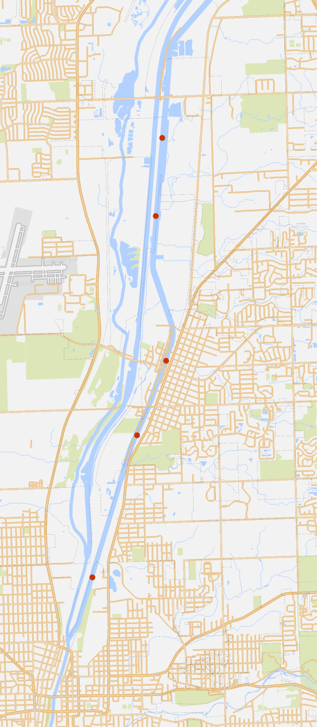
Distances between mile markers on I&M Canal
Distances between mile markers on I&M Canal
Get the EXIF data for the five mile marker photos in the directory with this notebook.
The JPEGs are named “marker27.jpg” through “marker31.jpg.”
The JPEGs are named “marker27.jpg” through “marker31.jpg.”
In[]:=
dir=NotebookDirectory[];
In[]:=
exifs=Table[Import[StringJoin[dir,"marker",ToString[m],".jpg"],"Exif"],{m,27,31}];
Get the locations of each photo, which are the locations of each marker.
In[]:=
locs=Table[GeoPosition[{exifs[[n]]["GPSLatitude"],-exifs[[n]]["GPSLongitude"]}],{n,1,5}]
Out[]=
{GeoPosition[{41.633,-88.059}],GeoPosition[{41.6183,-88.0607}],GeoPosition[{41.5911,-88.0581}],GeoPosition[{41.577,-88.0654}],GeoPosition[{41.5502,-88.0767}]}
Calculate the geodesic distances between the markers.
In[]:=
distances=Table[GeoDistance[locs[[n]],locs[[n+1]]],{n,1,4}]
Out[]=
,,,
In[]:=
GeoListPlot[locs,GeoRange->{{41.522,41.659},{-88.1,-88.02}},ImageSize->Large]
Out[]=