CITE THIS NOTEBOOK: Wolfram R&D LIVE: Computational Geology by Jeff Bryant. Wolfram Community NOV 15 2022.
Query for a list of entities in the “GeologicalPeriod” entity type:
In[]:=
EntityValue["GeologicalPeriod","Entities"]
Out[]=
List the properties in the “GeologicalPeriod” entity type:
In[]:=
Out[]=
,,,,,,,,,,,,,,,,,,,,,,,,,,,,,,,
List some prominent biological events that happened during the Ordovician Period:
In[]:=
Out[]=
{Cambrian-Ordovician extinction event at start,appearance of vertebrates,appearance of coral reefs,great diversity of trilobites, mollusks, echinoderms, and brachiopods,appearance of land plants,Ordovician-Silurian extinction events ended the period}
List some of the families of dinosaurs that lived during the Cretaceous Period:
In[]:=
Out[]=
,,,,,,,,,,,,,,,,,,,,,,,,,,,,,,,,,,,,,,,,,,,,,,,,,,,,,,,,,,,,,,,,,
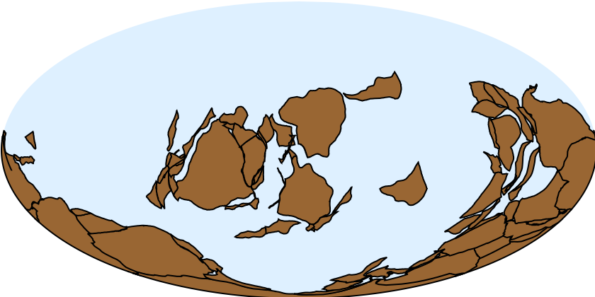
Query for the available sets of polygons that represents continental plate positions during the Ordovician Period:
In[]:=
Choose a specific snapshot of continental plate positions during the Ordovician Period and plot them using GeoGraphics:
In[]:=
GeoGraphicsGeoStyling[{Brown,EdgeForm[Black]}],["ContinentalPlates"],GeoBackground->LightBlue,GeoProjection->"Mollweide"
Out[]=
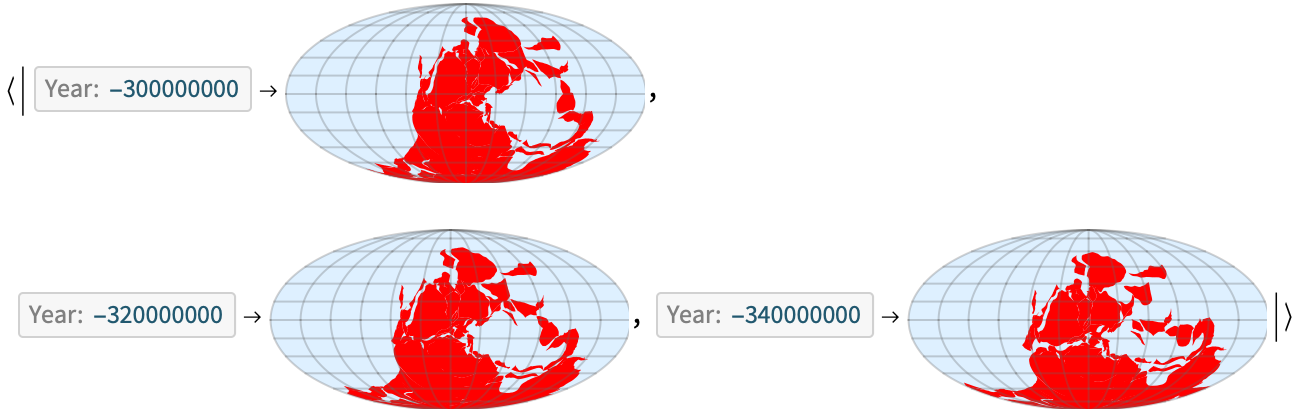
Query for the available sets of polygons that represents continental plate positions during the Carboniferous Period:
Compare the results above to those returned by the “ContinentalPlateMaps” Wolfram Function Repository item that automaticall assembles the GeoGraphics for you:
In[]:=
Out[]=
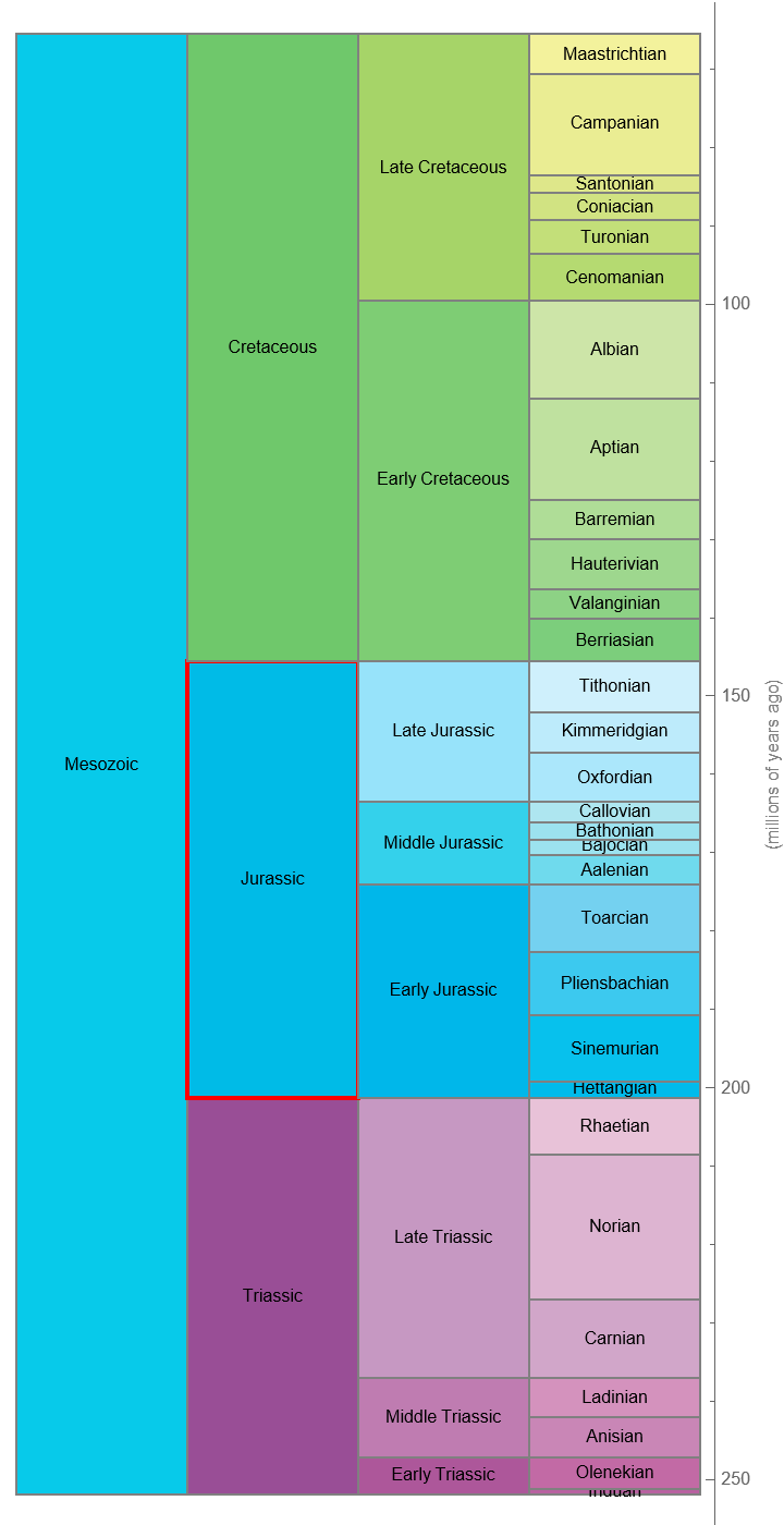
Use the Wolfram Function Repository to construct a chronology of a specific geological period and put it in context with other periods:
In[]:=
ResourceFunction["GeologicalPeriodChronologyChart"],3,BaseStyle->8,AspectRatio->Full,ImageSize->{Automatic,700}
Out[]=
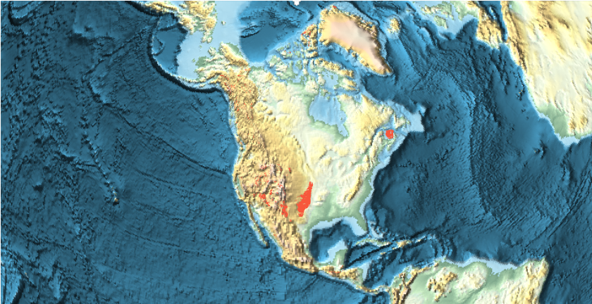
Use GeoGraphics and the “BedrockPolygon” property of the “GeologicalPeriod” entity type to construct a map showing where bedrock of that age can be found:
In[]:=
GeoGraphicsEntityValue,EntityFunction[e,{GeoStyling[e["CGMWColor"]],e["BedrockPolygon"]}],GeoBackground->"ReliefMap"
Out[]=
Use the Wolfram Function Repository to construct the same map more conveniently:
In[]:=
ResourceFunction["GeologicalPeriodBedrockPlot"],GeoCenter->,GeoRange->Quantity[500,"Miles"]
Out[]=
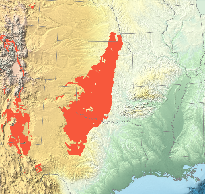
Construct more complicated maps by specifying multiple geological periods:
Construct a TimelinePlot for a geological period: