CITE THIS NOTEBOOK: Bedrock geology of North and Central America by Jeffrey Bryant. Wolfram Community OCT 10 2022.
One of the basic ideas of modern geology is the Law of Superposition. This basically states that younger rocks are laid down on top of older rocks. In its purest form and ignoring everything else, all of the rocks around the Earth would appear like a giant lasagna with the oldest rocks buried deeply below the youngest rocks everywhere you look. Using data from the Geologic Map of North America, the soil can be stripped away and the bedrock that lies underneath North and Central America can be color coded based on the age of the rocks found on the surface of the bedrock. The surface of the bedrock is not of the same age.
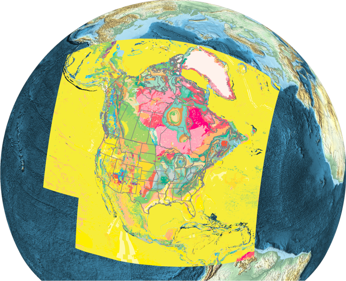
Events such as volcanism, uplift, erosion, deposition, and folding are among the processes that make the simple lasagna model of the rock layers more complicated and interesting. They can even give hints as to what happened in the geologic past.
Personal Experience
Personal Experience
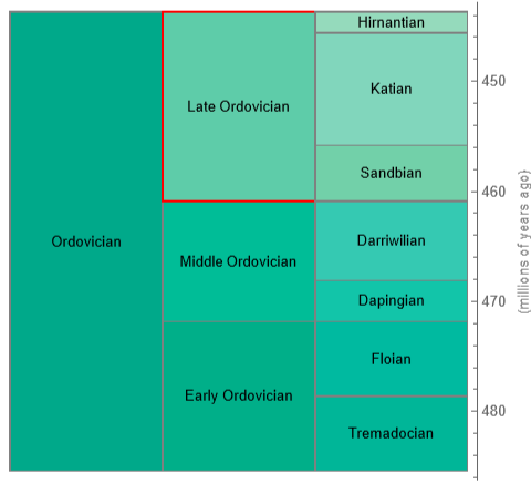
As a child and continuing all the way through college, I always had an interest in dinosaurs. Early in college, the movie Jurassic Park came out and dinosaur popularity exploded. I even took a new experimental course about dinosaurs (biology, living environments, etc). I took a number of other geology classes as well, including historical geology, and my first fossil hunting trip in southeast Indiana. Though this fossil hunting site was not looking for dinosaurs, but creatures more than 250 million years before dinosaurs even appeared on the scene. This soon led me to one of my favorite geological periods, the Ordovician Period. More specifically, the Late Ordovician Epoch and the Katian Age within that, were the time periods that my first major fossil hunt were laid down. I used the Wolfram Function Repository (WFR) to create functionality allowing you to place the geological time periods next to each other for context. Colors shown are the colors standardized by the Commission For the Global Map of the World for use in geological maps. As shown, the Late Ordovician and the Katian Age are about 450 million years old.
Out[]=
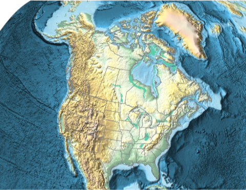
As mentioned previously, I had relatively easy access to publically accessible fossil hunting localities in southeast Indiana and southwest Ohio. You can visualize the location of the bedrock of this period using another WFR, which is similar to GeoGraphics, but made more convenient for viewing this data. The color is a kind of turquoise blue and you can see an area of this age of bedrock near the Ohio/Indiana border.
Out[]=
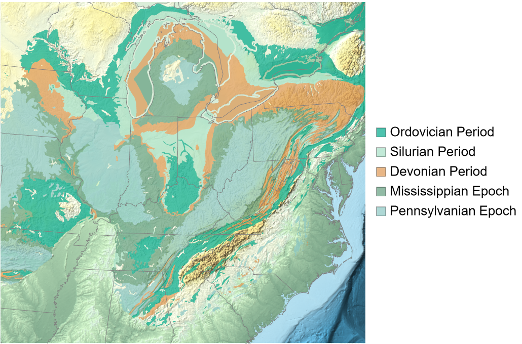
Zooming in further and including additional bedrock ages, its possible to examine multiple rock deposits on one map. The bedrock in most of the mid-west is sedimentary rock laid down during the Paleozoic Era when the area was either buried under shallow seas, resulting in limestone deposits, or under swampland, resulting in the numerous coal beds found throughout the area.
In[]:=
Out[]=
Here’s a photograph I took of my favorite fossil hunting site in southeast Indiana that exposes some of the Late Ordovician/Katian bedrock along road cuts in the area with wide shoulders for easy parking and exploring. Surface collecting was allowed, but no digging.
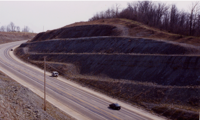
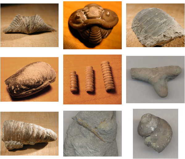
At the time these rocks were deposited, much of the midwestern United States was under a shallow sea. The rocks are sedimentary, primarily limestone, made from the uncountable number of crushed “sea shells” from invertebrate animals that lived in the oceans at that time. Here’s a sample of some of the fossils I’ve collected from this Ordovician bedrock site.
Out[]=
At the time these rocks and fossils were laid down, Laurentia (ancient core of the North American continent), was on or just south of the equator. Using another WFR item, you can see the position of Larentia as the medium sized land mass just left of center at a time period during the Late Ordovician Epoch.
Out[]=
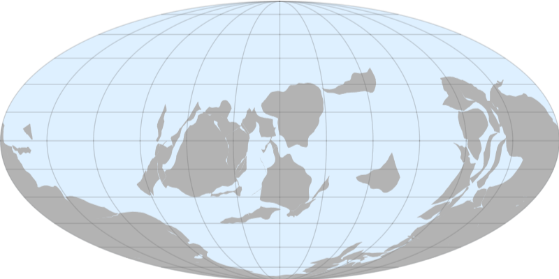
Laurentia was rotated approximately 90 degrees clockwise compared to its current orientation so that the modern east coast of North America was pointed south. Something not shown on such continental plate maps is that much of the continent was under a shallow sea, including most of modern day Indiana and Ohio.
Exploring Other Geological Periods
Exploring Other Geological Periods
Eons
Eons
Eons are the longest division of geological time, spanning hundreds of millions of years. The Precambrian, which spans about 88% of geologic time, can be considered a supereon, but this is an unofficial designation. The earliest eon is the Hadean Eon, technically informal but commonly used. In the following charts and maps, the colors are the standard colors defined by the Commission for the Global Map of the World.
During this time period, the Earth had no solid surface and was molten so no rocks from this period exist. The next geological eon, and technically the earliest that is officially recognized, is known as the Archean Eon. It was during this time period that the first rocks and the first cratons, seeds of the modern continents, formed. This time period is still very ancient and many of the rocks from this time period have been recycled in the intervening eons. However, there are locations where rocks from this time period can be found. In North America, Archean bedrock can be found in Canada and along the coast of Greenland with smaller instances in the northern U.S. in states such as Minnesota and Wisconsin and a few scattered places in the Rocky Mountains.
The area of pink shown above is known as the Canadian Shield or Laurentian Plateau and is exposed at the surface in many areas. This rock is igneous in nature meaning it was formed from cooled magma and represents the most stable part of North American bedrock.
The next eon was the Proterozoic Eon. It was likely during this time period that modern plate tectonics evolved. Earlier eons happened during a period of higher mantle temperatures and the crust wasn’t brittle enough to allow plate tectonics. It was only at the end of the Proterozoic Eon that complex animal life started to make an appearance. Life prior to and during the majority of the Proterozoic, and earlier, was simple single-celled organisms.
Proterozoic bedrock is spread out over a wider area and in a few more isolated spots, but is concentrated along the eastern coast of Canada and the eastern edge of the Canadian shield.
The Phanerozoic, a word that derives from the Greek words for visible life, is the most recent and current eon and includes all time periods starting with the Cambrian Period to modern day.
Phanerozoic eon bedrock is spread out over the entire dataset. Its clear that most of the bedrock found across North and Central America, including the ocean basins surrounding them, has a more recent history compared to the previous eons.
Periods and Epochs
Periods and Epochs
Drilling down further from the widest time ranges describe above, and skipping geological eras for brevity, data is available for shorter time spans as well. Bedrock from shorter time spans cover smaller areas. At this time resolution, there are many periods to choose from.
I'll examine a couple here. For anyone familiar with dinosaurs, the Cretaceous Period should ring a bell. This was the last period within the Mesozoic Era and the end of it coincided with the disappearance of the non-avian dinosaurs.
The bedrock for this period is more commonly found in the American and Canadian west, with famous outcrops in the Dakotas and Montana. Conditions in the eastern United States either weren’t optimal for deposition of Cretaceous rocks or any that were laid down have since been eroded away.
Exploring the Entire Set of Data
Exploring the Entire Set of Data
Exploring the set of all bedrock polygons can be done, with a word of caution. This is a lot of data and will take up a lot of memory and render time.
The results shows the full extent of the supported data which extends well out into the surrounding oceans. The color shown for the ocean areas is mostly yellow, indicating that it is Quaternary in age.
The Quaternary is the current and most recent time period. The fact that the age of the ocean is so young is due to continental drift and the creation of new oceanic bedrock since the breakup of Pangea. As North America split from Europe and Africa, new ocean bedrock was created in between and that bedrock is all relatively young in age.
There is a lot more geologic time that can be explored using these tools, but this is just a starting point that hopefully gets your attention. Hopefully, in the future, more complete global datasets are made available so other areas of the globe can be explored as well.