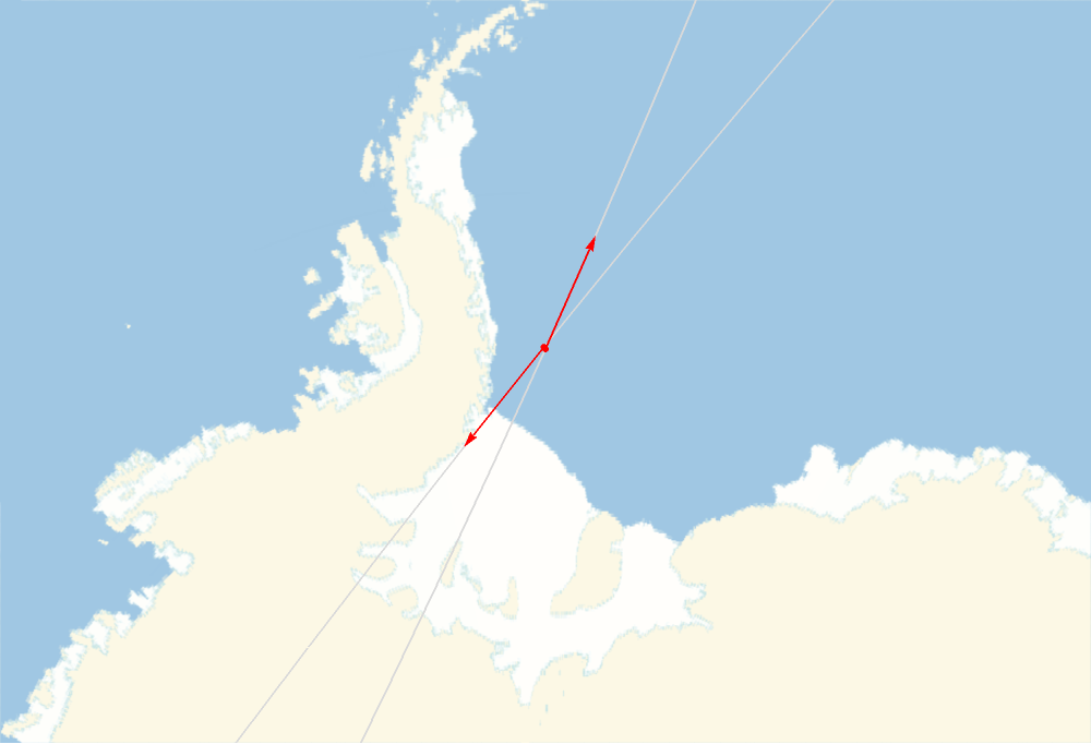
Apparently, late on Oct 15 Eastern time, there is a possibility that a deactivated satellite and a piece of debris, COSMOS 2004 and CZ-4C R/B (a Chinese rocket body), will collide about 990km above the earth, which is kind of a high elevation for low-Earth orbit. They are traveling in opposite directions, but the collision is not guaranteed as the orbits and speed carry a certain amount of uncertainty. If it happens, it will be around 19:56 Central (00:56 GMT) (according to media reports) on Oct 15.
Since playing with the following code, the TLE has been updated at least once so the results may change as we get closer as the NORAD TLE feed revises the TLEs for the satellites.
In[]:=
date=DateObject[{2020,10,16,0,56,30},TimeZone0];
In[]:=
data=EntityValue,,{Dated["Position",date],EntityProperty["Satellite","PositionLine",{"Date"date,"MinimumOrbitFraction"0,"MaximumOrbitFraction".01}],EntityProperty["Satellite","PositionLine",{"Date"date,"MinimumOrbitFraction"-.05,"MaximumOrbitFraction".06}]};
In[]:=
GeoGraphics[{LightGray,data[[All,3]],Red,Point[data[[All,1]]],Arrowheads[.015],Arrow@@@data[[All,2]]},GeoRangeQuantity[700,"Miles"],ImageSize500,GeoProjection"Orthographic",GeoCenterdata[[1,1]]]
Out[]=
A TimeSeries can be constructed from the relative positions and GeoDistances.
In[]:=
ts=With{dr=DateRange[DateObject[{2020,10,16,0,56,0},TimeZone0],DateObject[{2020,10,16,0,57,0},TimeZone0],"Second"]},TimeSeriesTransposedr,GeoDistance@@@TransposeEntityValue,,Dated["Position",#]&/@dr,TimeZone0
Out[]=
TimeSeries


In[]:=
DateListPlot[ts,FrameLabelAutomatic,PlotLabel"Separation Distance"]
Out[]=
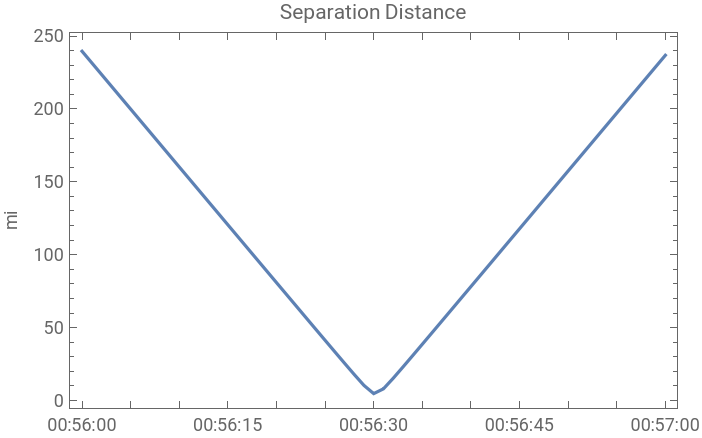
As we get closer to the time of closest approach, orbital TLEs may get revised and confirm or rule out a collision.