Mapping Wildfires with the Wolfram Language
By Arnoud Buzing
By Arnoud Buzing
Wildfires have been spreading in multiple states recently. California is suffering the most with some of its largest wildfires in history. Oregon has 20 large wildfires covering over 400,000 acres. And even Washington is not being spared this year.
To get a sense of where the current wildfires are, I implemented a function called WildfireData which sources data from NASA’s MODIS instruments aboard its Terra and Aqua satellites (code included at the end of this post):
https://modis.gsfc.nasa.gov/
This WildfireData function can be accessed through the following global ResourceFunction URI:
https://modis.gsfc.nasa.gov/
This WildfireData function can be accessed through the following global ResourceFunction URI:
WildfireData=ResourceFunction["user:arnoudb/DeployedResources/Function/WildfireData"]
We can now immediately use this function to get the currently available wildfire data from NASA:
data=WildfireData[]
The output is a dataset with several columns. The first column holds the geographical location of a wildfire observation and the second column holds its brightness:
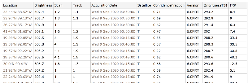
We can start by plotting all the locations on a map:
GeoGraphics[{Red,Point[data[All,"Location"]]}]
The output shows the observed wildfires:
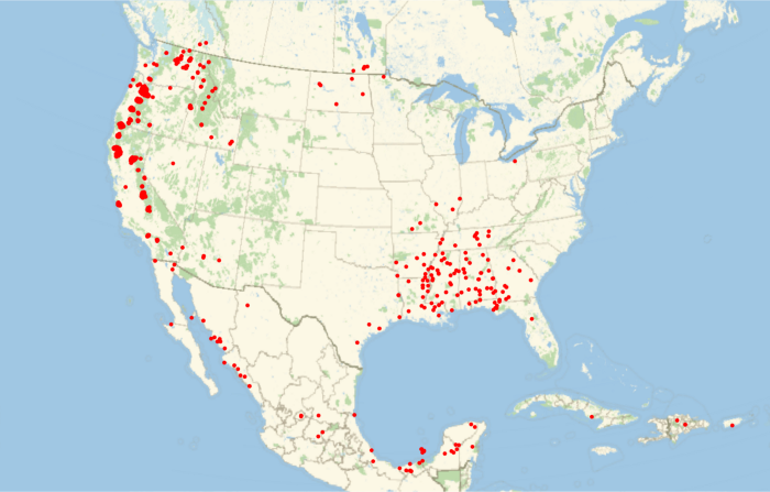
At this zoom level, it looks like there are quite a few wildfires in the South, but we can zoom into, for example, Mississippi to see up close:
ms=Entity["AdministrativeDivision",{"Mississippi","UnitedStates"}];
GeoGraphics[{Blue,Polygon[ms],Red,Point[data[All,"Location"]]},GeoRangems]
Up close it becomes clear these wildfires are quite scattered and standalone:
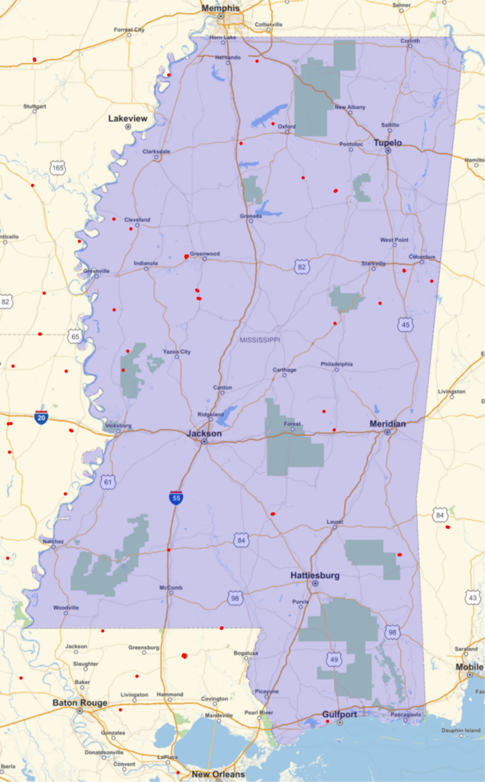
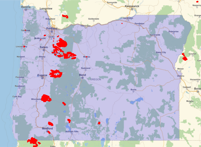
We can compare Mississippi to Oregon to see the difference:
or=Entity["AdministrativeDivision",{"Oregon","UnitedStates"}];
GeoGraphics[{Blue,Polygon[or],Red,Point[data[All,"Location"]]},GeoRangeor]
There are a far greater number of wildfires in Oregon:
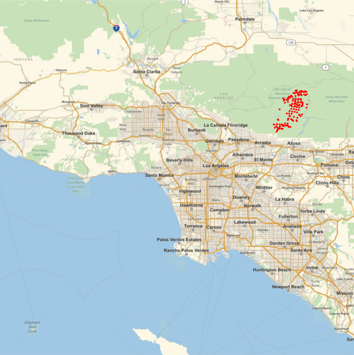
We can zoom in on any area, for example, the area within 40 miles of the center of Los Angeles:
la=Entity["City",{"LosAngeles","California","UnitedStates"}];
GeoGraphics[{Red,Point[data[All,"Location"]]},GeoRangeGeoDisk[la,Quantity[40,"Miles"]]]
There are many wildfires in the San Gabriel mountains:
There are also large wildfires east of Salem, Oregon:
area=Entity["City",{"Salem","Oregon","UnitedStates"}]
GeoGraphics[{Red,Point[data[All,"Location"]]},GeoRangeGeoDisk[area,Quantity[60,"Miles"]]]
This shows a very big cluster of wildfires:
Unfortunately, the wildfire season in the West is not expected to end until November. So far, in California alone, over 3,000,000 acres have burned with an estimated cost of $800,000,000. Oregon has lost over 600,000 acres and Washington has lost over 500,000 acres.
Code for the WildfireData function: