With[{ds=ResourceData@ResourceObject["Fireballs and Bolides"]},​​ds[ReverseSortBy[#Altitude&]/*(;;5)]]
Out[]=
PeakBrightness
Coordinates
NearestCity
Altitude
Velocity
VelocityXComponent
VelocityYComponent
VelocityZComponent
TotalRadiatedEnergy
CalculatedTotalImpactEnergy
Mon 12 Aug 2013 18:08:02
34.4°S 118.2°E
Albany
66.6km
-
-
-
-
44GJ
0.15kt
Thu 21 Nov 2013 01:50:35
44.7°N 35.3°E
Ordzhonikidze
59.3km
-
-5km/s
-11km/s
-2.7km/s
75GJ
0.23kt
Wed 18 Mar 2015 00:04:50
5.4°S 159.3°E
Buala
50km
-
-
-
-
121GJ
0.36kt
Wed 7 Jan 2015 01:05:59
45.7°N 26.9°E
Andreiasu de Jos
45.5km
-
-35.4km/s
1.8km/s
-4.4km/s
136GJ
0.4kt
Fri 16 May 2014 12:42:48
44.2°S 176.2°W
Owenga
44km
-
14.4km/s
4.6km/s
6.5km/s
309GJ
0.82kt
In[]:=
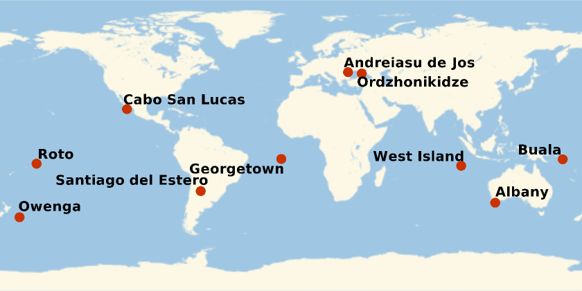
With[{ds=ResourceData@ResourceObject["Fireballs and Bolides"]},​​GeoListPlot[ds[ReverseSortBy[#Altitude&]/*(;;10),"NearestCity"],GeoLabelsTrue]​​]
Out[]=